Recherche
6 items
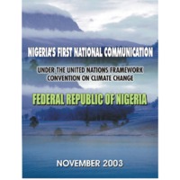
CNUCC Nigeria's initial national communication
Nigeria with a total area of 923,800 sq km occupies about 14& of land area in West Africa. The country lies between 4oN and 14oN, and between 3oE and 15oE. It is bordered respectively in the north, east, and west by Niger, the Cameroon, and Benin Republic, while the Gulf of Guinea, an arm of the Atlantic Ocean, forms the southern border. Most of Nigeria is covered with Pre- Cambrian rocks, but there are also metamorphic and sedimentary rocks of Eocene times as well as volcanic rocks. In general, three types of geologic structures exist in Nigeria, namely, areas of uplift, basins of sedimentation, and isolated volcanic areas. The areas of uplift are made up of the oldest rocks in Nigeria - the basement complex rocks.The basins of sedimentation are the down-warped areas, which were drowned by the sea at different times and in which sediments eroded from the areas of uplift were laid down.
Ghana medium term agriculture sector investment plan (metasip)
The Medium Term Agriculture Sector Investment Plan (METASIP) (2011 – 2015) has been developed using a largely participatory process and based on FASDEP II objectives with a target for agriculture sector GDP growth of at least 6& annually and government expenditure allocation of at least 10& of the national budget within the plan period. These targets are in conformity with agricultural performance targets of the country’s National Development Planning Commission (NDPC), the ECOWAP of ECOWAS and the CAADP of NEPAD and are expected to contribute significantly to the achievement of the MDGs of the United Nations Organization. As a sector investment plan, emphasis throughout the Plan has been on concerted consultations and actions by all stakeholders of the sector. The key stakeholders include MOFA, other relevant MDAs, DPs, NGOs, academia, civil society, farmers and other on-farm and off-farm private sector operators, researchers and service providers. Agriculture continues to be the largest sector of Ghana’s economy, contributing about 39& of GDP compared to about 26& for the industry sector and 31& for the services sector. Arable and industrial crop production has increased only marginally over the last 10 years with the only exception being cocoa which increased significantly between 2000 and 2005. Cotton and coffee production declined very significantly in the last decade. While there is little reliable information on the livestock sub-sector, it is known that the country’s meat situation is deficit to the tune of over 95,000 metric tonnes annually. There is similarly a deficit of about 460,000 metric tonnes with respect to fish. The identified basic problems of the agriculture sector include: reliance on rainfed agriculture and low level and relatively inefficient irrigated agriculture; low level of mechanization in production and processing; high post harvest losses as a result of poor post harvest management; low level and ineffective agricultural finance; poor extension services as a result of several institutional and structural inefficiencies; lack of ready markets and processing; low performing breeds of livestock; poor feeding of livestock; high cost of feed for poultry; poor livestock housing and husbandry management; competition from imports and poor post-production management of livestock products; over-fishing of natural waters; undeveloped fish value chain (e.g. inadequate supply systems for fingerlings and feed) and lack of skills in aquaculture. Strategies in the Plan to improve agricultural performance therefore focus on investments to address these constraints and to improve agricultural productivity and enhance market access. The six Programmes of the Plan which correspond to the six FASDEP II objectives have each been presented along development themes termed Components. POCC analysis was applied to the development issues of the themes to derive outputs and activities. It is envisaged that the Plan will be implemented by existing structures in the MDAs and other stakeholder organizations and that the Policy Coordinating and Monitoring Unit of the Office of the President and the NDPC will play key oversight roles during implementation. MOFA will xii facilitate the coordination of partnerships at all levels and play a lead role in the monitoring and evaluation of the Plan
PANA Ghana
Ghana lies on the south central coast of West Africa between latitudes 4.50N and 11.50N and longitude 3.5oW and 1.3oE. It shares a common border with the Republic of Togo on the east, Burkina Faso on the north and la Cote d’Ivoire on the west respectively. Ghana covers an average area of 238,539 square kilometers. Extensive water bodies including the Lakes Volta and Bosomtwe occupy 3,275 square kilometers while seasonally flooded lakes occupy another 23,350 square kilometers. The territorial waters extend 200 nautical miles out to sea. The country's population is estimated at 19.7 million (1999) and is believed to be growing at a rate between 2.8 and 3.0 percent per annum. The birth rate is estimated at 39 per thousand (1999) while the death rate is estimated at 10 per thousand (1999). The rate of infant mortality is approximately 66 per thousand life births while the overall life expectancy is 59 years (1999). The total fertility rate within the period 1996 to 1999 is estimated as 6.0. All the major rivers in Ghana flow into the sea (see figure 2.4). The only area of internal drainage is found around Lake Bosomtwe, where only streams flow from the surrounding highlands into the lake. The river valleys show diverse characteristics. The valleys of all the major rivers are bordered by terraces showing the former width and height of the rivers. Whilst some of the valleys are guided in their direction by relief (Morago river for example flows east-west along the foot of the Gambaga escarpment) or by structure. The two main sources of water supply for the rivers are rainfall and spring. In areas with single rainfall maximum as in the north, the rivers are intermittent. However, in areas with high and well distributed rainfall within the year, the rivers flow throughout the year. Temperatures throughout the country are typically high. The mean annual temperature is generally above 24ºC, a consequence of the low latitude position of Ghana and the absence of high altitude areas. Average figures range between 24 and 300C although temperatures ranging from 18 to 40ºC or more are common in the southern and northern parts respectively. Spatial variability of temperature is experienced in terms of the diurnal and annual ranges as a result of distance from the modifying influence of the sea breeze. Generally rainfall in Ghana decreases from south to north. The wettest area is the extreme southwest where annual rainfall is about 2000mm. In the extreme north, the annual rainfall is less than 1100mm. The driest area is the wedgelike strip from east of Sekondi-Takoradi, extending eastward up to 40km where the annual rainfall is about 750mm. The dry conditions in the southeastern coastal strip are anomalous and are the cause of important differences in ecology and landuse from the rest of the country. Ghana is classified as a developing country with a per capita income GDP of US$ 390 (1996). Agriculture and livestock constitute the mainstay of Ghana’s economy, accounting for 25.4& of GDP in 1996. Although cocoa is perhaps the country’s best known crop, other food crops and livestock are by far the most important contributors to agricultural output and alone make up around 25& of GDP (1996). 2 Agriculture and livestock employs 55& of the economically active population. It is predominantly small holder, traditional and rain-fed, with 85& of the country’s 1.8 million farms being smaller than 2 hectares. Only about 12& of Ghana's land area (28, 680km2) is classified as arable or permanently cropped land. Cocoa is the main cash crop and is grown on 40& of the cropped land. It accounts for about 75& of agricultural exports. Other commercially important tree crops are oil palm, coconut palm, rubber, kola and robusta coffee. The strong dependence on agriculture for economic development is of great concern with respect to potential climatic changes. Since almost all the national agricultural production is based on rainfall, the country’s agricultural output is directly influenced by weather patterns. During periods of severe drought crop production and livestock herds decline quite significantly. The severe food shortage experienced in the country in the early 1980's is a clear testimony of the dependence of the country's agriculture on climate change
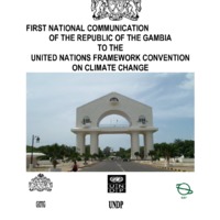
Republic of gambia, initial national communication
On behalf of the Government and people of the Republic of The Gambia, it is a great honour and pleasure for me to present this First National Communication of The Gambia to the United Nations Framework Convention on Climate Change (UNFCCC). The development of this First National Communications has enabled my Department of State to develop an institutional framework that has brought together and consolidated the networking and dialogue between different economic sectors, CBOs and NGOs, and grassroots level communities. Technicians and scientists of different backgrounds and disciplines have pooled their expertise and worked together to develop this informative document. In this National Communication we have outlined the emissions of greenhouse gases from the major economic sectors and activities of the country, developed plausible climate change scenarios and based on these scenarios we have assessed the potential impacts of the projected climate change. The National Communication also contains measures and strategies to mitigate the concentration of greenhouse gases in the global atmosphere and adapt to the negative impacts of climate change. No detailed cost-benefit analysis was conducted on the mitigation and adaptation measures due to inadequate capacity to cost the effects of climate change. The potential impacts of climate change on crop production, biodiversity and wildlife, coastal resources, forestry, fisheries, rangelands and livestock, and water resources have been studied in great detail. Most of the impacts are negative and the populations are vulnerable. Although The Gambia is a small country, there are opportunities to invest on small-scale projects to mitigate greenhouse gas emissions and adapt to adverse impacts of climate change. These projects would be in policy development, fuel switching including the efficient use of both renewable and non-renewable energy, use of efficient modes of transportation and conservation and sustainable use of forests. Cooperation between developed countries and The Gambia will enable all Parties to meet their commitments based on the principle of common but differentiated responsibility. The mitigation and adaptation measures presented in this first national communications will require funding to build national adaptive capacity and provide appropriate technologies to address climate change.
Republique du Cap Vert : communication nationale sur les changements climatiques
C’est évident, le fait que d'une certaine période jusqu'à présent on constate des altérations profondes dans les cycles globaux de la Planète, qui se trouve en crise et souffre des changements considérables, tout en présentant une atmosphère différente de celle de il y a quelques années. Ces changements se trouvent directement relationnés avec l'accumulation de certaines substances toxiques capables de fragiliser le système écologique. Face à l'évidence de que l'environnement global se trouve sous une forte pression des activités humaines, il existe aujourd'hui un vaste consensus dans la communauté scientifique et parmi les responsables politiques mondiaux qu'il est possible, que ces activités contribuent pour un changement climatique global sans précédents, car les émissions de gaz à effet de serre, en particulier, le dioxyde de carbone (CO2), chloroflucarbures (CFCs), méthane (CH4), hémioxydes d'azote et autres, sont en train de renforcer l'effet de serre naturel de l'atmosphère, pouvant éventuellement provoquer un réchauffement global dans la superficie de la Terre. . Le problème relatif aux conséquences dont la Planète peut se confronter avec l'augmentation continuelle de la concentration du dioxyde de carbone dans son atmosphère, avec l'émission sans contrôle des pollutions tel que le dioxyde de soufre (SO2), le méthane (CH4), les oxydes d'azote (NOx), les poussières et les fumées provenantes des activités industrielles et de la circulation des voitures, et autres gaz à effet de serre, il devient urgent que des mesures de correction soient prises et qu'elles puissent limiter et contrôler l'émission de ces gaz, définir des politiques concernant l'environnement adéquates à la réalité des pays visant le développement soutenu, effectiver la transférence nécessaire de technologies environnementales, former et informer les communautés des besoins d'utilisation de pratiques plus correctes qui puissent nous conduire à une gestion plus adéquate de l'environnement, et de mieux résoudre le problème d'appui et de renforcement institutionnel, aussi bien que la surveillance continuelle, les recherches et l'investigation systématique. Signée en juin 1992 dans la «Sommet de la Terre», à Rio de Janeiro, la Convention Cadre des Nations Unies sur les Changements Climatiques (CQNUMC) a pour finalité la stabilisation des concentrations de gaz à effet de serre (GEE) dans l'atmosphère à des niveaux qu'exigent des précautions en ce qui concerne l'interférence anthrope dans le climat de la Terre. La ratification par le Cap Vert de la CQNUMC a été en mars 1995 et elle est entrée en vigueur le 22 juin 1995. Prenant ça en considération, dans la condition de partie contractuelle de la Convention, le Cap Vert s'est engagé à cette date avec le compromis de formuler une Communication Nationale à la Conférence des Parties (CdP). Pour l'élaboration de la Communication Nationale du Cap Vert, on a tenu compte des différentes études effectuées dans les différents secteurs concernant des inventaires des GEE, l'analyse de vulnérabilité et adaptation et l'analyse de mitigation. La Communication Nationale montre la réalité capverdienne dans son processus de développement, ses problèmes de vulnérabilité et leur possible adaptation, rapporte toutes les procédures concernant l'émission de gaz à effet de serre dans les différents secteurs, elle projette des scénarios d'émission, propose des politiques et des mesures d'atténuation, et fait l’analyse des besoins de base concernants les ressources techniques et financiers pour le développement et la mise en œuvre du PNM (Plan National de Mitigation), aussi bien que le besoin d'assistance technique des organisations internationales visant l'identification et la définition d'une stratégie pour l'aboutissement du PNM.
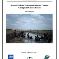
Second national communication on climate changes in guinea-bissau
For decades the international scientific community warned about the likely negative impacts of human activities on the equilibrium of ecosystems and global climate. Today it has been proved that the cause of global warming, which has been observed over the last fifty years, is anthropogenic, rather than natural. The weather events that occur (recurring droughts, frequent flooding, high winds, heat waves, rising sea levels, among others), initially predicted by scientists to occur at the end of the 21st century, is already becoming more frequent in several regions of the world with serious consequences for the survival of many societies.
