Recherche
64 items
2nd Seasonal Climate Forecast Forum for Soudano- Sahelian Africa: Final Communiqué
Experts in Climate, Agro-meteorology and Hydrology from the African Centre of Meteorological Application for Development, AGRHYMET Regional Centre, the National Agency for Civil Aviation and Meteorology of Senegal, representatives of West and Central African countries in charge of monitoring and producing agro-climatic and hydrometeorological information, as well as representatives from basin organisms of the region, met in Dakar(Senegal), from May 04 to 08,
2015 in order to produce seasonal forecasts of agro-hydro-climatic characteristics of the 2015 rainfall season and facilitate their application to food security and water resources management
4th Forum on the agro-hydro-climatic seasonal forecast in sudano-sahelian Africa (PRESASS, 2017)
A season with overall above average rainfall, an early to normal onset and equivalent or above average water levels in most river basins is expected in 2017.
Adapting to climate variability and change in smallholder farming communities: a case study from Burkina faso, Chad and Niger
Climate variability and change is regarded as having major impacts on key sustainable socio-economic and environmental indicators in Sub-Saharan West Africa. Because of these concerns, we investigated smallholders knowledge, skills, and aspirations about managing climate change, and document adaptation strategies used in the semi-arid regions coming from Burkina Faso, Chad and Niger. We analyzed climate data from the 1950’s to the present, including daily and aggregated rainfall and temperature variability, trends and extremes.
Agricultural land use mapping in west africa using multi-sensor satellite imagery
Rapid population growth in West Africa has led to expansion in croplands due to the need to grow more food to meet the rising food demand of the burgeoning population. These expansions negatively impact the sub-region's ecosystem, with implications for water and soil quality, biodiversity and climate. In order to appropriately monitor the changes in croplands and assess its impact on the ecosystem and other environmental processes, accurate and up-to-date information on agricultural land use is required. But agricultural land use mapping (i.e. mapping the spatial distribution of crops and croplands) in West Africa has been challenging due to the unavailability of adequate satellite images (as a result of excessive cloud cover), small agricultural fields and a heterogeneous landscape. This study, therefore, investigated the possibilities of improving agricultural land use mapping by utilizing optical satellite images with higher spatial and temporal resolution as well as images from Synthetic Aperture Radar (SAR) systems which are nearindependent of weather conditions. The study was conducted at both watershed and regional scales.
Catchment classification: multivariate statistical analyses for physiographic similarity in the upper niger basin
The objective of this study was to determine physiographic similarity, as indicator of hydrologic similarity between catchments located in the Upper Niger Basin, and to derive the dominant factors controlling each group singularity. We utilized a dataset of 9 catchments described by 16 physical and climatic properties distributed across a wide region with strong environmental gradients. Catchments attributes were first standardized before they underwent an integrated exploratory data analysis composed by Principal Component Analysis (PCA) followed by Hierarchical Clustering. Results showed a clear distribution into 2 major clusters: a group of easterly flat catchments and another of westerly hilly catchments. This nomenclature came from the interpretation of the main factors, topography and longitude, that seem to control the most important variability between both clusters. In addition, the hilly catchments were designated to be dominated by forest and ACRISOL soil type, two additional drivers of similarity. The outcome of this study can help understanding catchment functioning and provide a support for regionalization of hydrological information.
Climate change impacts on water and agriculture in west africa
Climate change is going to affect all aspects of the water cycle. The quantity and distribution of precipitation, the frequencies and duration of droughts, as well as evaporation rates and the water balance at plot level will be impacted by climate change. The African monsoon, which regulates the lives of 300 million West Africans, is evolving: the monsoon’s year-to-year variability will increase, as will the occurrence of extreme rainfall. Agricultural activity will be more or less strongly affected by this change depending on the agro-ecological zone and particular economic activity. The main scientific studies concur: mean annual runoff and groundwater recharge will decrease and competition for water will be exacerbated by growing demand for water by other uses, such as hydro-electric generation. Studies conducted by the African Monsoon Multidisciplinary Analysis (AMMA) are clear in stating that the variability in precipitation both in space and in time will be a real constraint on farm production. Society will need to adapt. Yet we should not underestimate the complexity of any given approach; thus, irrigation schemes should be consulted and agreed upon by all downstream principals and water users involved, even from a neighbouring country. Many methods and their local variations exist to mitigate the vagaries of water availability. Most try to increase production while at the same time reducing dependence on, and vulnerability to, inputs and limiting their negative effects on the environment. Techniques include water saving methods and methods to conserve biomass and soil fertility.
Climate change responses from west african states
The United Nations Framework Convention on Climate Change (UNFCCC) offers the developing countries some tools to evaluate their vulnerabilities to climate changes, to plan and to implement adaptation and mitigation policies and measures. Among them, National Action Plans for Adaptation (NAPAs) and National Communications are of particular importance, especially for West Africa. NAPAs identify urgent adaptation actions to be supported by international climate finance, after a participatory process aiming at identifying present and future vulnerabilities, as well as existing or innovative adaptation measures, and hierarchizing priorities. National Communications present national inventories of Greenhouse Gases (GHG) emissions and removals, as well as countries’ vulnerabilities in terms of climate changes, thus identifying adaptation and mitigation policies and measures. All Least Developed Countries (LDCs) of the CILSS/ECOWAS area have developed at least a NAPA or a National Communication; most have developed these two documents. However, the action of the West African countries is not limited to these tools. For over a decade, many national policies, particularly those relating to rural development and agriculture, have taken climate change into account and have planned specific actions on adaptation. In the case of Burkina-Faso, these include the National Action Programme to Combat Desertification (PAN-LCD), dealing with the prevention and management of climate hazards, the National Agriculture Investment Programme (PNIA) which addresses sustainable management of land, and the National Programme for the Rural Sector (PNSR), which includes the PNIA and provides for the adaptation of forest and agricultural resources, and the improvement of knowledge in terms of vulnerability and adaptation. In Niger, the PAN-LCD identifies climate as the first driver of desertification and focuses on the analysis and monitoring of climate changes. The PNIA aims at reducing the dependence of farming systems to climate hazards and the 3-N initiative ("Nigeriens feed Nigeriens"), which largely relies on the PNIA, quotes adaptation as one of the five challenges to food security.
Climate changes causes, manifestations, and effects in sahel
Published late 2013, the latest IPCC report demonstrates that the link between human activities and increasing temperatures observed since 1950 is very likely. These activities are manifested by massive emissions of Greenhouse Gases (GHGs) in the atmosphere, including carbon dioxide (CO2), methane (CH4), and nitrous oxide (N2O). Responsibilities are shared unequally between countries, but effects apply to everyone, especially African countries, particularly subSaharan ones. Yet, the African continent as a whole represents only 3.4& of global GHGs emissions and the CILSS/ECOWAS countries all together less than 1& of global emissions. At the global level, since the early 20th century, the temperature of the surface of the earth has increased by 0.8°C and sea levels rose from 19 cm. Each of the last three decades has been successively warmer than all previous decades since 1850! At the level of sub-Saharan Africa, climate changes are also important and disrupt farming activities, backbone of the economy: increase in the frequency of hot days and nights, heat waves, rainfall anomalies (annual and monthly volumes, heavy rains, consecutive dry days, start and end of the rainy season, etc.), increase in extreme weather events, etc. The example of the rainfall is striking: after experiencing an unprecedented drought in the world since the 1970s, West Africa has benefited from increased rainfall since the beginning of the 1990s, but with a strong interannual variability and more frequent episodes of heavy rains. The duration of the rainy season has decreased, while the frequency of flooding has increased. The impacts of climate changes are perceived by the West African populations, but their causes are not well understood. Informing these populations on climate changes, which will grow worse, is therefore an urgent challenge.
CNUCC NAPCD nigeria
The severity of desertification in the drylands of the world prompted the United Nations Organization to adopt a Convention to Combat Desertification (CCD), in 1994 for which National Action Programme (NAP) which Nigeria ratified in 1997. As a principal tool for the implementation of the Convention, parties are expected to prepare and implement NAP. Nigeria is a large country with a substantial part of its area extending into the Sudano-sahelian belt, which, together with the neigbouring northern Guinea savanna, constitutes the drylands of the country. With an estimated population of 113 million, human pressure on the land particularly in the marginal areas has continued to take its toll on the environment, resulting in desertification. Desertification is made very severe in the drylands of the country by increasing human attempts to exploit the resources of the ecological zone in the face of persistent drought. Before now, Nigeria has been tackling the problem of desertification the best way it could, but with little success. It is now obvious that the menace should be addressed in a holistic manner in order to ensure that the drylands of the country continue to support human and natural resources. This National Action Programme (NAP) spells out critical activities to be taken in a holistic manner to tackle the menace of desertification of the country. To facilitate a clear understanding of the NAP, an outline of the country’s environment is given, followed by a description of the extent and severity of desertification in the area. Also highlighted are the earlier efforts made to combat the menace, and the lesson learnt from such efforts. The NAP itself presents, guiding principles, issues, strategies and priority projects.
CNUCC Nigeria's initial national communication
Nigeria with a total area of 923,800 sq km occupies about 14& of land area in West Africa. The country lies between 4oN and 14oN, and between 3oE and 15oE. It is bordered respectively in the north, east, and west by Niger, the Cameroon, and Benin Republic, while the Gulf of Guinea, an arm of the Atlantic Ocean, forms the southern border. Most of Nigeria is covered with Pre- Cambrian rocks, but there are also metamorphic and sedimentary rocks of Eocene times as well as volcanic rocks. In general, three types of geologic structures exist in Nigeria, namely, areas of uplift, basins of sedimentation, and isolated volcanic areas. The areas of uplift are made up of the oldest rocks in Nigeria - the basement complex rocks.The basins of sedimentation are the down-warped areas, which were drowned by the sea at different times and in which sediments eroded from the areas of uplift were laid down.
COP 21 Special Newsletter for CILSS/ECOWAS/UEMOA Climate negotiators Towards a global climate agreement: a milestone in the Paris Conference negotiations
Le programme régional « Alliance Mondiale contre le Changement Climatique » (AMCC/GCCA) de l’espace CILSS/CEDEAO est une initiative du groupe Afrique-Caraïbes-Pacifique (ACP) financée par l’Union Européenne. Il vise, entre autres, à renforcer les capacités des pays de la sous-région sur les principaux enjeux liés aux négociations sur le climat. Ce bulletin est principalement destiné aux négociateurs, aux décideurs, à la société civile, aux ONG de l’espace CILSS/CEDEAO, mais aussi à tout lecteur interpellé par la question des changements climatiques. Cet espace dispose, en effet, d’une faible masse critique de négociateurs. Ce bulletin fait le bilan des négociations depuis la Convention de Rio (1992) jusqu’aux Accords de Doha (2012), en passant par la feuille de route de Bali (2007), l’Accord de Copenhague (2009), les Accords de Cancun (2010), le lancement de la Plateforme de Durban (2011). Il présente aussi les enceintes de négociations, les pays et groupes de pays en présence, les principales positions de négociation, les outils du négociateur. Ce bulletin met aussi en relief les points d’achoppement et de blocage des négociations. On insiste notamment sur les engagements des pays développés, la dichotomie entre pays Annexe 1 et pays non Annexe 1, la place des grands pays émergents (Chine Brésil, Inde, etc.), le principe de responsabilité commune mais différencié, etc. Le bulletin démontre également que l’effort global de réduction s’est réduit sur la 2ème période du Protocole de Kyoto 2013-2020 par rapport à 2008-2012. Le niveau d’ambition actuel est trop faible pour espérer rester sous les +2°C et éviter un dérèglement climatique annoncé par le GIEC. Un des points saillants de ce bulletin est le décryptage de l’agenda et des enjeux de la COP19 qui se tiendra du 11 au 22 novembre 2013 à Varsovie. Les principaux points des agendas (COP19, CMP9, SBSTA39, SBI39, ADP2-3) sont classés selon les cinq piliers du plan d’action de Bali à savoir la vision partagée, l’atténuation, l’adaptation, le transfert de technologies et le financement. Le premier point fera a priori l’objet de discussions intenses face aux blocages des négociations sur les engagements d’atténuation. Les positions du groupe Afrique issue de la Déclaration de Gaborone sur le changement climatique lors de la cinquième session extraordinaire de la Conférence ministérielle africaine sur l’environnement sont également présentées. Au regard de la position du groupe Afrique, des orientations spécifiques de négociations ont été identifiées pour l’espace CILSS/CEDEAO par les participants de l’atelier de préparation de la COP19 organisé par le CILSS en octobre 2013 à Ouagadougou. Enfin, le bulletin décrit le rôle et la place du CILSS en tant qu’institution régionale spécialisée sur le climat dans l’appui et l’accompagnement des négociateurs ouest africains
CPDN Session4présentationimpactagricra
Present and future climate change scenario at the global in West Africa region : Scientific elements and impact on agriculture
Desertification and climate change institutional responses and regional actions
The struggle against desertification and the protection of their natural resources has been a recurring theme since the 1970s in the policy documents of the West African States marked by the droughts of the Sahel. More recently, issues related to adaptation to climate change and its corollaries, how to adapt agriculture and maintain food security, have begun to be discussed even at the subregional level. Thus, many political and/or economic regional groupings of countries have defined strategic programmes or adopted legal instruments that allow them to integrate environmental questions into their action plans. It is not always easy to navigate the various programs and legal instruments. The regional and sub-regional institutions are many and often overlap thematically or geographically. Introduction The first section of this review presents policies and strategies on the environment and agriculture implemented on the African continent and in West Africa by a variety of institutions: the African Union (AU), the African Ministerial Conference on the Environment (AMCEN), the Economic Community of West African States (ECOWAS), the West African Economic and Monetary Union (UEMOA), and the Permanent Interstates Committee for Drought Control in the Sahel (CILSS). However difficult it may be to understand and to coordinate between these regional and sub-regional programmes, their very proliferation affirms the growing importance that the environment and its interdisciplinary nature has come to occupy since the Millenium Summit in 2000, where it was treated in isolation as one of the eight Millenium Development Goals (MDG). However, going beyond mere words, regional and sub-regional institutions, as well as the Member States themselves, have already taken action and have since the early 2000s begun to implement huge field actions involving efforts against desertification and land degradation, sustainable land and water use, reforestation, etc. We present only three field actions in this review but the list is much longer. This clearly demonstrates how the environment has become a cornerstone of sustainable development and a major concern of West African countries
Evaluating Groundwater Storage Change and Recharge Using GRACE Data: A Case Study of Aquifers in Niger, West Africa
Accurately assessing groundwater storage changes in Niger is critical for long-term water
resource management but is difficult due to sparse field data. We present a study of groundwater
storage changes and recharge in Southern Niger, computed using data from NASA Gravity Recovery
and Climate Experiment (GRACE) mission. We compute a groundwater storage anomaly estimate
by subtracting the surface water anomaly provided by the Global Land Data Assimilation System
(GLDAS) model from the GRACE total water storage anomaly. We use a statistical model to fill
gaps in the GRACE data. We analyze the time period from 2002 to 2021, which corresponds to the
life span of the GRACE mission, and show that there is little change in groundwater storage from
2002–2010, but a steep rise in storage from 2010–2021, which can partially be explained by a period
of increased precipitation. We use the Water Table Fluctuation method to estimate recharge rates
over this period and compare these values with previous estimates. We show that for the time range
analyzed, groundwater resources in Niger are not being overutilized and could be further developed
for beneficial use. Our estimated recharge rates compare favorably to previous estimates and provide
managers with the data required to understand how much additional water could be extracted in a
sustainable manner.
Evaluation of the Impact of Seasonal Agroclimatic Information Used for EarlyWarning and Farmer Communities’ Vulnerability Reduction in Southwestern Niger
Abstract: In Niger (a fully Sahelian country), the use of climate information is one of the early warning strategies (EWSs) for reducing socio-economic vulnerabilities in farmer communities. It helps farmers to better anticipate risks and choose timely alternative options that can allow them to generate more profit. This study assesses the impacts of the use of climate information and services that benefit end-users. Individual surveys and focus groups were conducted with a sample of 368 people in eight communes in Southwestern Niger. The survey was conducted within the framework of the
ANADIA project implemented by the National Meteorological Direction (NMD) of Niger. The survey aims to identify different types of climate services received by communities and evaluates the major benefits gained from their use. Mostly, the communities received climate (73.6%) and weather (99%) information on rainfall, temperature, dust, wind, clouds, and air humidity. Few producers in the area (10%) received information on seasonal forecasts of the agrometeorological characteristics of the rainy season. The information is not widely disseminated in the villages during the roving seminars conducted by the NMD. For most people, this information is highly relevant to their needs because of its practical advice for options to be deployed to mitigate disasters for agriculture, livestock, health, water resources, and food security. In those communities, 82% of farmers have (at least once) changed their routine practices as a result of the advice and awareness received according to the climate
information. The information received enables farmers (64.4%) to adjust their investments according to the profile of the upcoming rainfall season. The use of climate information and related advice led to an increase of about 64 bunches (equivalent to 10 bags of 100 kg) in annual millet production, representing an income increase of about 73,000 FCFA from an average farmland of 3 ha per farmer. In addition, the use of climate information helps to reduce the risks of floods and droughts, which often cause massive losses to crop production, animal and human life, infrastructure, materials, and goods. It has also enabled communities to effectively manage seeds and animal foods and to plan
social events, departures and returns to rural exodus. These analyses confirm that the use of climate information serves as an EWS that contributes to increasing the resilience of local populations in the Sahel.
Evaluation of weather parameters on maize production in Ouinhi, southern Benin Repiblic
The purpose of this study is to improve maize production by providing information on the influence of weather parameters on the performance of maize production in Ouinhi ( Benin).
Final Evaluation of the IDRC/DFID Climate Change Adaptation in Africa Programme
A confluence of rapid increases in population, explosive growth of urban centres and largely unsustainable agricultural practices leading to land degradation is set to make Africa lag behind other regions in development in the 21st century. Among the threats to a sustainable livelihood is the threat to the global commons in the form of climate change, which, according to the United Nations Framework Convention on Climate Change (UNFCCC), refers to a change of climate attributed directly or indirectly to human activity that alters the composition of the global atmosphere and that is in addition to the natural climate variability observed over comparable time periods. Climate change will result in greater variability and more frequent extremes like droughts and floods. It is acknowledged that climate change poses a significant risk to future African generations. Adaptation to climate variability and change offers a means of assessing and responding to potential impacts, with the goal of reducing the risk of adverse outcomes and increasing resilience in responding to stress. Adaptation is described as an adjustment in natural or human systems in response to actual or expected climatic stimuli or their effects that moderates harm or exploits beneficial opportunities. Adaptation can be anticipatory or reactive, private or public, autonomous or planned. With the goal of significantly improving the capacity of African populations and organisations to adapt to climate change in ways that benefit the most vulnerable, the Climate Change Adaptation in Africa (CCAA) research and capacity development programme was launched in 2006 as a jointly funded initiative of the Canadian International Development Research Centre (IDRC) and the UK Department for International Development (DFID). A strategy was designed to strengthen the capacity of African stakeholders to contribute to adaptation to climate change, support adaptation through action research, make the findings of scientists on climate variability and change more widely available and inform policy processes with high-quality science-based knowledge. In order to achieve the outlined goals and objectives, the programme incorporated three core activity areas: Participatory Action Research (PAR), capacity development and knowledge sharing. The expectation was that at the conclusion of the programme, research teams would be better able to assess climate-related vulnerabilities and evaluate and develop adaptation options; stakeholders would be better prepared to engage in knowledge sharing; the most vulnerable groups would be better equipped to implement improved adaptation strategies; and policy makers would be in possession of up-todate knowledge necessary for mainstreaming vulnerability and adaptation issues.
Ghana medium term agriculture sector investment plan (metasip)
The Medium Term Agriculture Sector Investment Plan (METASIP) (2011 – 2015) has been developed using a largely participatory process and based on FASDEP II objectives with a target for agriculture sector GDP growth of at least 6& annually and government expenditure allocation of at least 10& of the national budget within the plan period. These targets are in conformity with agricultural performance targets of the country’s National Development Planning Commission (NDPC), the ECOWAP of ECOWAS and the CAADP of NEPAD and are expected to contribute significantly to the achievement of the MDGs of the United Nations Organization. As a sector investment plan, emphasis throughout the Plan has been on concerted consultations and actions by all stakeholders of the sector. The key stakeholders include MOFA, other relevant MDAs, DPs, NGOs, academia, civil society, farmers and other on-farm and off-farm private sector operators, researchers and service providers. Agriculture continues to be the largest sector of Ghana’s economy, contributing about 39& of GDP compared to about 26& for the industry sector and 31& for the services sector. Arable and industrial crop production has increased only marginally over the last 10 years with the only exception being cocoa which increased significantly between 2000 and 2005. Cotton and coffee production declined very significantly in the last decade. While there is little reliable information on the livestock sub-sector, it is known that the country’s meat situation is deficit to the tune of over 95,000 metric tonnes annually. There is similarly a deficit of about 460,000 metric tonnes with respect to fish. The identified basic problems of the agriculture sector include: reliance on rainfed agriculture and low level and relatively inefficient irrigated agriculture; low level of mechanization in production and processing; high post harvest losses as a result of poor post harvest management; low level and ineffective agricultural finance; poor extension services as a result of several institutional and structural inefficiencies; lack of ready markets and processing; low performing breeds of livestock; poor feeding of livestock; high cost of feed for poultry; poor livestock housing and husbandry management; competition from imports and poor post-production management of livestock products; over-fishing of natural waters; undeveloped fish value chain (e.g. inadequate supply systems for fingerlings and feed) and lack of skills in aquaculture. Strategies in the Plan to improve agricultural performance therefore focus on investments to address these constraints and to improve agricultural productivity and enhance market access. The six Programmes of the Plan which correspond to the six FASDEP II objectives have each been presented along development themes termed Components. POCC analysis was applied to the development issues of the themes to derive outputs and activities. It is envisaged that the Plan will be implemented by existing structures in the MDAs and other stakeholder organizations and that the Policy Coordinating and Monitoring Unit of the Office of the President and the NDPC will play key oversight roles during implementation. MOFA will xii facilitate the coordination of partnerships at all levels and play a lead role in the monitoring and evaluation of the Plan
Impacts of climate change over forest ecosystems and related vulnerability
La fonction et la structure des écosystèmes forestiers sont en partie déterminées par les conditions climatiques environnantes. La distribution des précipitations et la moyenne des températures définissent le type d'écosystème forestier d’un milieu. Par conséquent, les changements climatiques influencent les forêts et partant entraîne des changements dans la production de produits et services importants pour la société. Cet article présente une brève introduction à ce sujet
Improving Weather Forecasts in West Africa Using WRF Model
The lack of weather and climate information at appropriate scales is one of the major obstacles to disaster risk reduction in West Africa. The AGRHYMET Regional Climate Center for West Africa and its partners have undertaken to implement projects aimed at filling these gaps. It has equipped itself with the technical infrastructure and established the necessary expertise to produce Numerical Weather Prediction (NWP) with the Weather Research and Forecasting Model (WRF) model to provide NMHSs with information and tailored products for their operational activities. Since 2021, AGRHYMET has been equipped with a high-performance computing facility and has started implementing the WRF model to make short and medium-range forecasts. Thus, there is a need to assess the accuracy of the outputs that have been obtained so far to facilitate the improvement of the whole WRF modeling process at AGRHYMET. In this info note, we have explored the methodology used to assess WRF outputs at AGRHYMET and presented some preliminary results.
Landscapes of west africa : a window on changing world
Beyond raising awareness, the atlas also aims to incite action to protect the environment of West Africa and the Sahelian region. We therefore invite everyone — scientists, students, researchers, teachers, planners, managers of development or research projects, local, national and regional decision-makers, donors, members of civil society organizations, and visitors to the region — to make the most of this work.
Learning agenda on cis - mercy corps two pager final
While investments in climate information services (CIS) are on the rise, little objective evidence exists concerning efficacy and learning for future investments. To address these gaps, the Climate Information Services Research Initiative (CISRI) will: • Improve understanding of, and access to, knowledge on the effectiveness of CIS programming. • Produce evidence and tools to improve understanding of the factors and structures that influence CIS delivery, uptake, use and effectiveness. • Produce innovative evaluation methodologies and evidence on the degree of effectiveness of CIS. • Research, design and implement a plan for the dissemination, uptake and application of research, synthesis, evidence, and knowledge gaps.
Learning agenda on cis - winrock two pager final
Africa is one of the most vulnerable continents to climate variability and change due to its high exposure to climate shocks and stresses (e.g., droughts) and relatively low adaptive capacities (IPCC Fifth Assessment Report, 2014). In sub-Saharan Africa (SSA) rain-fed agriculture, which is vital for a large percentage of the rural population and contributes significantly to GDP, is particularly vulnerable. Providing decision-makers with timely, accurate information on climate and weather variations can help inform decisions that enhance agricultural production and avoid harvest loss, thereby improving food security, lifting agricultural incomes, and increasing the resilience of farmers to future shocks and stresses. However, the generation and delivery of climate information services (CIS) in SSA is significantly underfunded. To advance our understanding on how to bridge the funding gap this project will: • Develop metrics to assess sustainable and effective provision of CIS by National Meteorological and Hydrological Services (NMHSs) and others, and conduct a baseline assessment of current gaps; • Identify business models for CIS and options to improve the sustainability of NMHSs including collaboration with the private sector; and • Build partnerships, synthesis knowledge, and ensure uptake of lessons.
Learning agenda on climate services overview factsheet final
In sub-Saharan Africa (SSA), more than 65 percent of the population derive their livelihood from rain-fed agriculture. This makes the rural economies in SSA especially susceptible to weather and climate. Providing decision-makers - from individual farmers, to agribusinesses, to government officials - with timely, accurate information on climate and weather variations helps inform decisions. Informed decisions can increase agricultural production and avoid harvest loss, thereby improving food security, raising agricultural incomes, and ultimately increasing the resilience of farmers to shocks and stresses. While climate information services (CIS) have been used with success in other regions of the world, they are used to a much lower extent in SSA. Even as investments in CIS in SSA are increasing, the generation and delivery of CIS in the region remains underfunded. To ensure these growing investmests result in improved rural livelihoods and sustainable CIS systems, objective evidence regarding the effectiveness of CIS investments is needed. Research is also needed regarding the socio-economic circumstances that constrain the use of such services in SSA, as well as business models appropriate for CIS production and delivery in SSA.
Mitigation of climate change funding in west africa
Although they are low emitters, West African countries are invited, like all Parties to the UNFCCC, to reduce their Greenhouse Gases (GHGs) emissions, according to their national capacities and circumstances. Mitigation in developing countries is promoted by the UNFCCC with three tools: Nationally Appropriate Mitigation Actions (NAMAs), Clean Development Mechanism (CDM), and Intended Nationally Determined Contributions (INDCs). NAMAs are voluntary for developing countries and can cover a variety of sectors: energy, transport, forestry, etc. They are published by the UNFCCC, with the objective to attract funding from the international community. However, so far, they are no specific guidelines neither dedicated funding. Up to now, only 15 countries have submitted NAMAs to the UNFCCC, and among them, Mali is the only one from the CILSS/ECOWAS area. The CDM allows developed countries to meet part of their commitments by financing emission reduction projects in developing countries. Many limitations explain that these projects have benefited little to Africa: carbon price fluctuations, complexity of the procedures, high transaction costs, complicated rules for reforestation, etc. Finally, the concept of INDC is very recent and it is not yet clear how these contributions will be supported. The opportunities offered by the UNFCCC for financing adaptation and mitigation actions are tenuous: the target of 100 billion US$/year by 2020 is not credible in the absence of short-term financing and the Green Climate Fund, key element of the financial mechanism of the UNFCCC, is still not operational. However, outside of the UNFCCC, fundings are available for mitigation, especially in the agriculture and forest sectors: Forest Carbon Partnership Facility (FCPF), Forest Investment Programme (FIP), Global Alliance against Climate Change (GCCA), International Climate Initiative of Germany (ICI), and Japan Initiative for Fast-Start Actions. In the short term, the West African countries could better benefit from the CDM, by advocating for its adaptation to their national circumstances, as well as from the NAMAs, by requesting the development of guidelines and dedicated funding. In the medium and long term, in the absence of tangible prospects under the UNFCCC, the integration of mitigation-related goals in the "traditional" projects of donors would probably remain the most obvious opportunity to finance the mitigation in West Africa.
Multi-site validation of the swat model on the bani catchment: model performance and predictive uncertainty
The objective of this study was to assess the performance and predictive uncertainty of the Soil and Water Assessment Tool (SWAT) model on the Bani River Basin, at catchment and subcatchment levels. The SWAT model was calibrated using the Generalized Likelihood Uncertainty Estimation (GLUE) approach. Potential Evapotranspiration (PET) and biomass were considered in theverificationofmodeloutputsaccuracy. GlobalSensitivityAnalysis(GSA)wasusedforidentifying important model parameters. Results indicated a good performance of the global model at daily as well as monthly time steps with adequate predictive uncertainty. PET was found to be overestimated but biomass was better predicted in agricultural land and forest. Surface runoff represents the dominant process on streamflow generation in that region. Individual calibration at subcatchment scale yielded better performance than when the global parameter sets were applied. These results are very useful and provide a support to further studies on regionalization to make prediction in ungauged basins.
National adaptation plans technical guidelines for the national adaptation plan process
The Least Developed Countries Expert Group (LEG) was established in 2001 to support least developed countries (LDCs) in addressing the adverse impacts of climate change. Since that time, the LEG, in accordance with its original mandate, has provided technical guidance and advice to LDCs on the preparation and implementation of their national adaptation programmes of action (NAPAs). Through its new mandate, received at the sixteenth session of the Conference of the Parties (COP) in 2010 in Cancun, Mexico, the LEG now also provides technical guidance and advice on: the revision and update of NAPAs; the strengthening of gender considerations and considerations regarding vulnerable communities; the integration of NAPAs into development planning; the identification and implementation of medium- and long-term adaptation; and the implementation of the LDC work programme. Furthermore, the LEG also provides technical guidance and support to the national adaptation plan (NAP) process. These technical guidelines have been developed by the LEG, with input and feedback from the Global Environment Facility (GEF) and its agencies, and experts from other organizations,to support the NAP process, following a request by the COP. They offer a range of options for dealing with each element of the NAP process, and are based on the guiding principles of the NAP process. The NAP process was established to build on the rich experiences of the LDCs in addressing adaptation through the NAPAs, and through it, to address medium- and longterm adaptation. The process aims to assist LDCs to reduce their vulnerability to the impacts of climate change, by building adaptive capacity and resilience, and by facilitating the integration of climate change adaptation into development planning. As laid out in the initial guidelines that were adopted at COP 17, the technical guidelines are framed around the four elements of the NAP process: laying the groundwork and addressing gaps; preparatory elements; implementation strategies; and reporting, monitoring and review. The technical guidelines are not prescriptive, and countries can decide on the specific steps for their national process. They are developed in a way that seeks to enhance the coherence of adaptation and development planning within countries, rather than duplicating efforts undertaken or underway. They are intended to facilitate country-owned, country-driven action, that seeks to harness and build upon national-level capacity, with support from various partners, as appropriate. They are designed in a way that allows countries to monitor and review it on a regular basis, and update their NAPs in an iterative manner. These technical guidelines will assist the LDCs in comprehensively addressing adaptation in a coherent and strategic manner. They will assist countries to develop clearly defined adaptation programmes that countryowned, country-driven, and that catalyze action beyond the implementation of adaptation projects. The LEG recognizes that LDCs will continue to rely on the active support by the LEG and other partners, and stands ready to provide any support regarding the application of these guidelines, and on the overall NAP process.
National adaptation programme of action on climate change
Scientific conclusions indicate that the "warming of the climatic system is a reality”, while it is "very likely" that anthropic activities play an important role in temperature rise. Effectively, global temperatures have risen by about one degree since the end of the nineteenth century, while the levels of CO2 concentration in the atmosphere have increased and accumulated by approximately 30& during the same period.
Niamey declaration of the 3rd CICC2024
For a holistic governance of the management of disaster risks caused by extreme climatic events in West Africa in the Sahel
PANA Ghana
Ghana lies on the south central coast of West Africa between latitudes 4.50N and 11.50N and longitude 3.5oW and 1.3oE. It shares a common border with the Republic of Togo on the east, Burkina Faso on the north and la Cote d’Ivoire on the west respectively. Ghana covers an average area of 238,539 square kilometers. Extensive water bodies including the Lakes Volta and Bosomtwe occupy 3,275 square kilometers while seasonally flooded lakes occupy another 23,350 square kilometers. The territorial waters extend 200 nautical miles out to sea. The country's population is estimated at 19.7 million (1999) and is believed to be growing at a rate between 2.8 and 3.0 percent per annum. The birth rate is estimated at 39 per thousand (1999) while the death rate is estimated at 10 per thousand (1999). The rate of infant mortality is approximately 66 per thousand life births while the overall life expectancy is 59 years (1999). The total fertility rate within the period 1996 to 1999 is estimated as 6.0. All the major rivers in Ghana flow into the sea (see figure 2.4). The only area of internal drainage is found around Lake Bosomtwe, where only streams flow from the surrounding highlands into the lake. The river valleys show diverse characteristics. The valleys of all the major rivers are bordered by terraces showing the former width and height of the rivers. Whilst some of the valleys are guided in their direction by relief (Morago river for example flows east-west along the foot of the Gambaga escarpment) or by structure. The two main sources of water supply for the rivers are rainfall and spring. In areas with single rainfall maximum as in the north, the rivers are intermittent. However, in areas with high and well distributed rainfall within the year, the rivers flow throughout the year. Temperatures throughout the country are typically high. The mean annual temperature is generally above 24ºC, a consequence of the low latitude position of Ghana and the absence of high altitude areas. Average figures range between 24 and 300C although temperatures ranging from 18 to 40ºC or more are common in the southern and northern parts respectively. Spatial variability of temperature is experienced in terms of the diurnal and annual ranges as a result of distance from the modifying influence of the sea breeze. Generally rainfall in Ghana decreases from south to north. The wettest area is the extreme southwest where annual rainfall is about 2000mm. In the extreme north, the annual rainfall is less than 1100mm. The driest area is the wedgelike strip from east of Sekondi-Takoradi, extending eastward up to 40km where the annual rainfall is about 750mm. The dry conditions in the southeastern coastal strip are anomalous and are the cause of important differences in ecology and landuse from the rest of the country. Ghana is classified as a developing country with a per capita income GDP of US$ 390 (1996). Agriculture and livestock constitute the mainstay of Ghana’s economy, accounting for 25.4& of GDP in 1996. Although cocoa is perhaps the country’s best known crop, other food crops and livestock are by far the most important contributors to agricultural output and alone make up around 25& of GDP (1996). 2 Agriculture and livestock employs 55& of the economically active population. It is predominantly small holder, traditional and rain-fed, with 85& of the country’s 1.8 million farms being smaller than 2 hectares. Only about 12& of Ghana's land area (28, 680km2) is classified as arable or permanently cropped land. Cocoa is the main cash crop and is grown on 40& of the cropped land. It accounts for about 75& of agricultural exports. Other commercially important tree crops are oil palm, coconut palm, rubber, kola and robusta coffee. The strong dependence on agriculture for economic development is of great concern with respect to potential climatic changes. Since almost all the national agricultural production is based on rainfall, the country’s agricultural output is directly influenced by weather patterns. During periods of severe drought crop production and livestock herds decline quite significantly. The severe food shortage experienced in the country in the early 1980's is a clear testimony of the dependence of the country's agriculture on climate change
PANLCD Gambie
The Second National Forum adopted the “National Action Programme to Combat Desertification in The Gambia” in Banjul on the 27th of September 2000. Preparation of the National Action Programme (NAP) was coordinated by the Forestry Department, the Focal Point for implementing the United Nations Convention to Combat Desertification in The Gambia (UNCCD). Formulation of the NAP was the result of a broad, consultative process, involving central government and its line agencies, local government institutions, Non Governmental Organisations and, most importantly, communities all over the country whose perceptions, views and proposal were gathered in zonal and divisional meetings, numerous interviews and statements. At the First National Forum held in November 1998, five thematic areas were identified for in-depth consideration in the NAP. These included: Forestry and Wildlife Management; Agriculture, Soil and Water Conservation; Livestock Production and Range Management; Population and Social Dimensions of Desertification; and Institutional Arrangements. Five separate sectoral studies were prepared by international and national consultants, identifying the key issues for each sector, progress made in the fight against desertification, and areas requiring immediate and medium-term action. Based on this analysis, the Second National Forum was held, and the final National Action Programme adopted. Technical and financial support was extended by the Deutsche Gesellschaft für Technische Zusammenarbeit (GTZ) GmbH, through the Deutsche Forstservice (DFS) GmbH, the United Nations Sahelian Office (UNSO), the United Nations Development Programme (UNDP), the Secretariat of the UNCCD, and the Permanent Inter-State Committee to Combat Drought in The Sahel (CILSS). The Gambia is, a small and poor country, but, nevertheless, has made substantial progress in key areas of relevance to The Convention. Headway has been made in The Gambia in reversing the trend of deforestation, and the future looks promising in these areas indeed. In fact, elements of the Gambia Forestry Management Concept are being taken-up in the Sub-Region and beyond. The National Action Programme is structured with a brief introduction and presentation of background information on The Gambia in Sections 1 and 2. These sections set the stage for the discussion of the impact of desertification in The Gambia in Section 3. Section 4 covers the NAP preparation process and provides a synopsis of analysis provided by the five sectoral studies commissioned during the NAP preparation. Finally, the National Action Programme is detailed in Section 5, including guiding principles, priority measures, institutional and financial arrangements, and monitoring and evaluation of the NAP. A brief summary of the Second National Forum with key conclusions and recommendations follows. In Appendix A, a matrix summarises the key stra 3 tegic areas requiring priority action. A full investment programme will follow in early 2001. On behalf of the Government of The Gambia, I would like to express my deep appreciation to the numerous NAP contributors, namely, the Desertification Core Group, the Task Force on Desertification, the Agriculture and Natural Resources (ANR) Working Group, representatives from technical line agencies, Non-Governmental Organisations (NGOs), Community Based Organisations (CBOs), national and international consultants, donors, and above all, the invaluable input from the communities. The Action Programme is by no means an end in and of itself, but a call for action. Success or failure will have to be gauged against perceivable and tangible improvements in the livelihood of Gambian communities. Hence, there is no “final version” of the Action Programme. NAP is a process, which involves continuous correction, revision and refinement. All institutions, the international community and, above all, the Gambian public are encouraged to further contribute to the process through their critical participation.
PANLCD Ghana
Desertification has long been recognized as a major environmental hazard with adverse impacts on the livelihoods of people in the affected regions. In many parts of Africa, desertification has contributed to the increasing poverty of the people and the gradual but irreversible degradation of the ecosystem. Ghana has been greatly concerned about the expansion of desert conditions in most parts of the country. She has been working with the global community, international and national organizations in finding a lasting solution to this problem that threatens the livelihoods of many people. In spite of the fact that the preparation of the National Action Programme (NAP) to Combat Drought and Desertification was hampered by inadequate and outmoded data, this document puts together both desktop and field evidence in a coherent way. Evidently the gaps identified in the data sources should spur the country on to improve on data collection. This NAP is intended to highlight the nation’s efforts at achieving sustainable development and re-emphasize the support Ghana requires to fully participate in anti desertification efforts. The preparation of this document has undoubtedly contributed to the creation of awareness about the dangers of desertification in the country. It is hoped that if the necessary resources are mobilized for the implementation of the programmes and activities identified in this document, then the nation would be strengthened and empowered to pursue sustainable development pathways. The implementation of these programmes will ensure good agricultural practices, food security, poverty alleviation and sustainable exploitation of our natural resources and ultimately lead to the achievement of the goals of the Convention on Drought and Desertification.
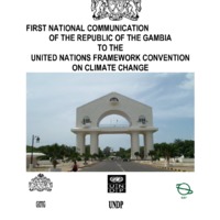
Republic of gambia, initial national communication
On behalf of the Government and people of the Republic of The Gambia, it is a great honour and pleasure for me to present this First National Communication of The Gambia to the United Nations Framework Convention on Climate Change (UNFCCC). The development of this First National Communications has enabled my Department of State to develop an institutional framework that has brought together and consolidated the networking and dialogue between different economic sectors, CBOs and NGOs, and grassroots level communities. Technicians and scientists of different backgrounds and disciplines have pooled their expertise and worked together to develop this informative document. In this National Communication we have outlined the emissions of greenhouse gases from the major economic sectors and activities of the country, developed plausible climate change scenarios and based on these scenarios we have assessed the potential impacts of the projected climate change. The National Communication also contains measures and strategies to mitigate the concentration of greenhouse gases in the global atmosphere and adapt to the negative impacts of climate change. No detailed cost-benefit analysis was conducted on the mitigation and adaptation measures due to inadequate capacity to cost the effects of climate change. The potential impacts of climate change on crop production, biodiversity and wildlife, coastal resources, forestry, fisheries, rangelands and livestock, and water resources have been studied in great detail. Most of the impacts are negative and the populations are vulnerable. Although The Gambia is a small country, there are opportunities to invest on small-scale projects to mitigate greenhouse gas emissions and adapt to adverse impacts of climate change. These projects would be in policy development, fuel switching including the efficient use of both renewable and non-renewable energy, use of efficient modes of transportation and conservation and sustainable use of forests. Cooperation between developed countries and The Gambia will enable all Parties to meet their commitments based on the principle of common but differentiated responsibility. The mitigation and adaptation measures presented in this first national communications will require funding to build national adaptive capacity and provide appropriate technologies to address climate change.
Republique du Cap Vert : communication nationale sur les changements climatiques
C’est évident, le fait que d'une certaine période jusqu'à présent on constate des altérations profondes dans les cycles globaux de la Planète, qui se trouve en crise et souffre des changements considérables, tout en présentant une atmosphère différente de celle de il y a quelques années. Ces changements se trouvent directement relationnés avec l'accumulation de certaines substances toxiques capables de fragiliser le système écologique. Face à l'évidence de que l'environnement global se trouve sous une forte pression des activités humaines, il existe aujourd'hui un vaste consensus dans la communauté scientifique et parmi les responsables politiques mondiaux qu'il est possible, que ces activités contribuent pour un changement climatique global sans précédents, car les émissions de gaz à effet de serre, en particulier, le dioxyde de carbone (CO2), chloroflucarbures (CFCs), méthane (CH4), hémioxydes d'azote et autres, sont en train de renforcer l'effet de serre naturel de l'atmosphère, pouvant éventuellement provoquer un réchauffement global dans la superficie de la Terre. . Le problème relatif aux conséquences dont la Planète peut se confronter avec l'augmentation continuelle de la concentration du dioxyde de carbone dans son atmosphère, avec l'émission sans contrôle des pollutions tel que le dioxyde de soufre (SO2), le méthane (CH4), les oxydes d'azote (NOx), les poussières et les fumées provenantes des activités industrielles et de la circulation des voitures, et autres gaz à effet de serre, il devient urgent que des mesures de correction soient prises et qu'elles puissent limiter et contrôler l'émission de ces gaz, définir des politiques concernant l'environnement adéquates à la réalité des pays visant le développement soutenu, effectiver la transférence nécessaire de technologies environnementales, former et informer les communautés des besoins d'utilisation de pratiques plus correctes qui puissent nous conduire à une gestion plus adéquate de l'environnement, et de mieux résoudre le problème d'appui et de renforcement institutionnel, aussi bien que la surveillance continuelle, les recherches et l'investigation systématique. Signée en juin 1992 dans la «Sommet de la Terre», à Rio de Janeiro, la Convention Cadre des Nations Unies sur les Changements Climatiques (CQNUMC) a pour finalité la stabilisation des concentrations de gaz à effet de serre (GEE) dans l'atmosphère à des niveaux qu'exigent des précautions en ce qui concerne l'interférence anthrope dans le climat de la Terre. La ratification par le Cap Vert de la CQNUMC a été en mars 1995 et elle est entrée en vigueur le 22 juin 1995. Prenant ça en considération, dans la condition de partie contractuelle de la Convention, le Cap Vert s'est engagé à cette date avec le compromis de formuler une Communication Nationale à la Conférence des Parties (CdP). Pour l'élaboration de la Communication Nationale du Cap Vert, on a tenu compte des différentes études effectuées dans les différents secteurs concernant des inventaires des GEE, l'analyse de vulnérabilité et adaptation et l'analyse de mitigation. La Communication Nationale montre la réalité capverdienne dans son processus de développement, ses problèmes de vulnérabilité et leur possible adaptation, rapporte toutes les procédures concernant l'émission de gaz à effet de serre dans les différents secteurs, elle projette des scénarios d'émission, propose des politiques et des mesures d'atténuation, et fait l’analyse des besoins de base concernants les ressources techniques et financiers pour le développement et la mise en œuvre du PNM (Plan National de Mitigation), aussi bien que le besoin d'assistance technique des organisations internationales visant l'identification et la définition d'une stratégie pour l'aboutissement du PNM.
Sahel and West Africa Program in Support of the Great Green Wall Initiative
Sahelian Africa faces a persistent problem of variability in rainfall, which is the major driver of vulnerability in the region. Populations in the Sahel are among the poorest and most vulnerable to climatic variability and land degradation. They depend heavily on healthy ecosystems for rainfed agriculture, fisheries, and livestock management to sustain their livelihoods. These constitute the primary sectors of employment in the region and they generate at least 40 percent of the gross domestic product (GDP) in most of the countries. Furthermore, ecosystem services provide much needed livelihood products, such as fuelwood and bushmeat, among others. Unfortunately, increasing
population pressures on food, fodder, and fuelwood in a vulnerable environment have
deteriorating impacts on natural resources, notably vegetation cover. Climate variability along with frequent droughts and poorly managed land and water resources (surface and underground) have caused rivers and lakes to dry up and contribute to increased soil erosion.
Second national communication on climate changes in guinea-bissau
For decades the international scientific community warned about the likely negative impacts of human activities on the equilibrium of ecosystems and global climate. Today it has been proved that the cause of global warming, which has been observed over the last fifty years, is anthropogenic, rather than natural. The weather events that occur (recurring droughts, frequent flooding, high winds, heat waves, rising sea levels, among others), initially predicted by scientists to occur at the end of the 21st century, is already becoming more frequent in several regions of the world with serious consequences for the survival of many societies.
Soil atlas of africa part 1
Arwyn Jones, European Commission Joint Research Centre, Italy (Chair); Henrik Breuning-Madsen, University of Copenhagen, Denmark; Michel Brossard, Institut de recherche pour le développement, Montpellier, France; Almami Dampha, African Union Commission, Ethiopia; Jozef Deckers, KU Leuven, Belgium; Olivier Dewitte, European Commission Joint Research Centre, Italy; Tahar Gallali, Faculté des Sciences de Tunis, Tunisia; Stephen Hallett, World Soil Survey Archive and Catalogue, Cranfield University, UK; Robert Jones, World Soil Survey Archive and Catalogue, Cranfield University, UK; Method Kilasara, Sokoine University of Agriculture, Tanzania; Pieter Le Roux, University of the Free State, South Africa; Erika Micheli, Szent Istvan University, Hungary / IUSS WRB WG; Luca Montanarella, European Commission Joint Research Centre, Italy; Otto Spaargaren, ISRIC- World Soil Information, The Netherlands; Lamourdia Thiombiano, FAO Regional Office for Africa, Ghana; Eric Van Ranst, Ghent University, Belgium; Martin Yemefack, IRAD, Cameroon; Robert Zougmoré, International Crops Research Institute for the Semi-Arid Tropics (ICRISAT), Mali.
Soil atlas of africa part 2
Arwyn Jones, European Commission Joint Research Centre, Italy (Chair); Henrik Breuning-Madsen, University of Copenhagen, Denmark; Michel Brossard, Institut de recherche pour le développement, Montpellier, France; Almami Dampha, African Union Commission, Ethiopia; Jozef Deckers, KU Leuven, Belgium; Olivier Dewitte, European Commission Joint Research Centre, Italy; Tahar Gallali, Faculté des Sciences de Tunis, Tunisia; Stephen Hallett, World Soil Survey Archive and Catalogue, Cranfield University, UK; Robert Jones, World Soil Survey Archive and Catalogue, Cranfield University, UK; Method Kilasara, Sokoine University of Agriculture, Tanzania; Pieter Le Roux, University of the Free State, South Africa; Erika Micheli, Szent Istvan University, Hungary / IUSS WRB WG; Luca Montanarella, European Commission Joint Research Centre, Italy; Otto Spaargaren, ISRIC- World Soil Information, The Netherlands; Lamourdia Thiombiano, FAO Regional Office for Africa, Ghana; Eric Van Ranst, Ghent University, Belgium; Martin Yemefack, IRAD, Cameroon; Robert Zougmoré, International Crops Research Institute for the Semi-Arid Tropics (ICRISAT), Mali.
Soil atlas of africa part 3
Arwyn Jones, European Commission Joint Research Centre, Italy (Chair); Henrik Breuning-Madsen, University of Copenhagen, Denmark; Michel Brossard, Institut de recherche pour le développement, Montpellier, France; Almami Dampha, African Union Commission, Ethiopia; Jozef Deckers, KU Leuven, Belgium; Olivier Dewitte, European Commission Joint Research Centre, Italy; Tahar Gallali, Faculté des Sciences de Tunis, Tunisia; Stephen Hallett, World Soil Survey Archive and Catalogue, Cranfield University, UK; Robert Jones, World Soil Survey Archive and Catalogue, Cranfield University, UK; Method Kilasara, Sokoine University of Agriculture, Tanzania; Pieter Le Roux, University of the Free State, South Africa; Erika Micheli, Szent Istvan University, Hungary / IUSS WRB WG; Luca Montanarella, European Commission Joint Research Centre, Italy; Otto Spaargaren, ISRIC- World Soil Information, The Netherlands; Lamourdia Thiombiano, FAO Regional Office for Africa, Ghana; Eric Van Ranst, Ghent University, Belgium; Martin Yemefack, IRAD, Cameroon; Robert Zougmoré, International Crops Research Institute for the Semi-Arid Tropics (ICRISAT), Mali.
Special Bulletin of the 2024 Seasonal forecasts of the Agro-Hydro-Climate characteristics for the Sahelian and Sudanian zones of West Africa and the Sahel PRESASS 2024
The 2024 Edition of the PRESASS was organized from April 22 to 26, 2024 in Abuja, Nigeria, by AGRHYMET Regional Climate Center for West Africa and the Sahem (AGRHYMET RCC-WAS) of the CILSS, in collaboration with ACMAD, the National Meteorological and Hydrological Services (NMHSs), WMO and the West African River Basin Organizations.
.......Generally a wet rainy season is expected in 2024 over the Sahelian belt, with late to normal starting dates of the agricultural season in the Sahel-Central and early to normal s in the Sahel-West and East; late to normal ending dates of the agricultural season; short dry spells at the beginning of the season in the Sahel-West and medium to long dry spells in the Sahel-East and generally long dry spells towards the end of the season over the entire Sahelian belt; and above-average runoff in the main Sahelian river basins.......
Successful adaptation strategies and measures in west africa traditions and innovations for sustainable land management
Already handicapped by increasing land pressure and continued land degradation, West African farmers face an additional challenge: to adapt their farming practices to climate changes. In West Africa, these changes should lead to increased water stress, the extension of arid areas and, ultimately, lower crop yields (IPCC, 2013). Cereal yields are expected to fall by 10 to 15& by 2025, while 20& of the population is already structurally vulnerable and food crises are regular (CILSS, 2013). The situation is difficult, but simple and effective techniques can be implemented to adapt farming practices. This means that, with few resources, the farmer may be able to improve its yields, while preserving its natural capital (the soil), and taking into account the future climate changes in West Africa. This involves making the best use of agricultural water, using collection techniques that aim at maintaining as long as possible the water in the fields. It also means combatting erosion due to the wind or heavy rains, introducing physical barriers in the fields. Finally, this implies to better manage physical and chemical soils properties, in order to maintain or restore their fertility. These techniques must be implemented in a complementary manner. Despite having shown very good results at plot level, their widespread adoption remains a challenge for West Africa. Restoration costs of degraded land in the CILSS/ECOWAS countries demonstrate the importance of this challenge: up to 100 million US$ per country (CILSS, 2013)
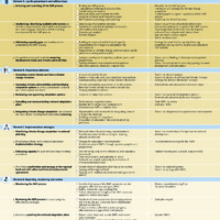
Table of steps, building blocks and sample outputs under each of the four elements of the nap process
TABLE Of STEPS, BuILDING BLOCkS AND SAMPLE OuTPuTS uNDER EACh Of ThE fOuR ELEMENTS Of ThE NAP PROCESS
The cilss day at cop 21 : the confirmation
Posters presentations : Four poster presentations have been made successively by CILSS Experts: Capitalization of good low-carbon practices of the AFOLU sector (Agriculture, Forestry and other land use) in CILSS/CEDEAO region, by Dr Maguette Kairé, Forestry Expert; From sustainable land management to the eco-villages of the Boala city, (Province of Namentega, region of the Central-North of Burkina Faso) by Dr. Benoît Sarr, Climate change Expert; CILSS platform in the field of climate change and sustainable land management, by Dr. Issaka Lona, climate change expert; Scaling of smart agriculture for food security in the Sahel, Dr. Edwige Botoni, Natural Resource Management Expert;
The great green wall a development programme for the sahara and the sahel
The Great Green Wall Initiative (GGW) was launched in Africa at the Summit of Heads of State and Government held in Burkina Faso in June 2005. Designed first to serve as a means to combat desertification and poverty, the initiative was initially limited to the establishment of a “green belt” of trees extending from Senegal to Djibouti.
Toolking for planing, monotorin and evaluation of climate change adaptive capacities
Climate change is among the most serious threats confronting every person on the entire planet, and African populations are particularly vulnerable. All livelihoods suffer from the isolated or combined effects of many climate hazards that can negatively affect their productivity, and consequently food security and populations’ living conditions. Therefore, seeking to reduce the harmful effects of climate hazards relates directly to the fight against poverty. Reducing poverty and promoting human development depend in part on the reduction of greenhouse gas concentration in the atmosphere to prevent climate change (mitigation). But given that climate change is already happening and will continue to do so because of current and still-rising levels of carbon dioxide (CO2) in the atmosphere, it is also necessary to develop robust ways for natural and human systems to adjust in the face of future climate change effects (adaptation). Discussions on climate change now recognize that in addition to efforts to mitigate the phenomenon, strategies to enhance adaptation are a priority. This recognition has led to the unprecedented proliferation of many initiatives (projects, programs and policies) that relate climate change to development efforts. These initiatives, however, have so far hardly generated the expected outcomes. The disappointing results are due, in part, to the approaches and tools that were used to identify, plan, monitor and evaluate the initiatives. A study undertaken by the United Nations Economic Commission for Africa (Somda, 2010) on the shortcomings in the fields of monitoring and evaluation shows that these approaches are not sufficiently harmonized; they do not permit the drawing of consistent lessons that could improve the relevant formulation and implementation of new initiatives for climate change adaptation. This publication aims to resolve this issue by offering insights into harmonized approaches and tools for identifying, planning, monitoring and evaluating climate change adaptive capacities. It presents the theoretical approach and includes a practical users’ guide intended for development professionals, researchers and policy-makers. It contains a toolkit that harmoniously combines a number of existing approaches and tools for use at various intervention scales, and in this way defines a vision and a behavioural change strategy that are essential in the climate change adaptation process.
United nations convention on biological diversity (uncbd) state of play and perspectives for west africa
More than in other places, millions of people in West Africa depend in large part on natural resources which continue to deteriorate. Each year more than 4 million ha of forest are lost in Africa and 80& of the forests in West Africa disappeared in the last century (FAO, 2010). 34 countries like Angola, Ethiopia, Gabon, and Mali continue to suffer a loss of biodiversity (UNEP, 2008). Genetic erosion in sub-Saharan Africa is accelerating and local food-producing seeds are disappearing at an alarming rate (FAO, 2012). Soil degradation affects almost 500 million people in Africa and two thirds of the arable land is exposed to degradation. The situation concerning water resources is just as troubling. Introduction The first part of this report gives a brief overview of the principles and mandates of the UNCBD and its two Protocols, Cartagena and Nagoya, and then presents its main bodies. The second section introduces how far the UNCBD has been implemented and discusses specific aspects of agrodiversity and bio-security in the African context, then at the sub-regional West African level, and finally at the level of the individual countries of West Africa. Never before have the humid zones and the bodies of water in West Africa been under such a strain. The area covered by Lake Chad, for example, has fallen from 25,000 ha to only 2,500 in 40 years. The direct pressures are aggravated by changes in the climate whose effects will be all the more damaging because West Africa is already so vulnerable. The objective of UNCBD and its additional Protocols of Nagoya and Cartagena is to maintain biological diversity, stop genetic erosion and ensure a just and equitable sharing of the benefits from the use of genetic resources. Nevertheless, while humanity is going through its 6th biodiversity crisis, the objective for 2010 – reduce the rate of biodiversity loss – has not been achieved and the national implementation of UNCBD’s measures remains limited in West Africa.
United nations framework convention on climate change (unfccc) state of play and perspectives for west africa
After the publication of the Brundtland Report in 1987, alerting the international community about the dangers of global changes, including climate changes, the Intergovernmental Panel of Experts on Climate Change (IPCC) is established in 1988. Soon after, at the Rio Earth Summit in 1992, the UNFCCC is created. It adopts an armed wing in 1997, the Kyoto Protocol, which enters into force in 2005. The first commitment period of the Protocol (2008-2012) did not address the issue, covering less than a third of global Greenhouse Gases (GHG) emissions and setting a modest target in terms of GHG emissions reduction (-5.2& in 2008-2012 compared to 1990). The opposition of the United States to any reduction of their GHG emissions ("The American way of life is not negotiable!" - George Bush, 1992) has often been put forward to explain the low ambition of the Protocol. The reality is less simple: the climate negotiations involve more than 190 countries with diverse interests and have become complex, far exceeding climate and abuting on geopolitical or even philosophical issues. This Protocol was supposed to be strengthened in 2009 at the Climate Conference in Copenhagen. Political tension was high before this Conference: "No plan B in case of failure" (Barroso, 2009). Five years later, the Plan B is still under negotiation... Agreeing on a multilateral treaty on the post2020 climate regime - by 2015 at the COP21 in Paris - is even more urgent that all signals are red, as evidenced by the last IPCC Report (2013). In addition, the last to pollute will be the first affected: developing countries that have low GHG emissions compared to industrialised countries already bear the brunt of the effects of climate change and will suffer even more. In this context, the West African countries ardently defend their positions: • Applying the principles of "Common But Differentiated Responsibility" (CBDR) and "Transparency" and asking the developed countries to be exemplary; • Increasing greatly climate finance in particular for adaptation; • Integrating agroforestry in the Clean Development Mechanism (CDM); • Operationalising the “Loss and Damage Mechanism”.
What are the prospects for mobile livestock systems in the face of the densification of rural areas and climate change in West Africa?
The dynamics of livestock systems in sub-Saharan West Africa on the 2040 horizon will be determined more by current and expected societal changes than by climate change. Climate change is expected to result in increases in the concentration of carbon dioxide in the air, in temperatures in the warmer seasons, and in rainfall mainly due to more frequent and intense heavy storms. These increases are expected to favour crop production, but also runoff, soil erosion and flooding. The rapid and persistent increase in rural population density despite dramatic urbanisation is expected to fuel further expansion of cultivated lands and the reduction and fragmentation of rangelands, hampering pastoral mobility. This is likely to reduce the activity of seasonally mobile pastoral livestock farming, but also that of sedentary livestock farming deprived of rangelands and a source of competitively priced young animals. A policy that would advocate the end of seasonal regional transhumance in favour of ranching and stabling, would precipitate the decline of pastoral livestock and increase their fragility in the face of climatic and security risks. This change would require an investment that is beyond the reach of livestock breeders, who would be reduced to working for private investors or agro-industrial companies. The only policy that could sustainably support livestock systems in their diversity and complementarity would be resolute public investment by States and Regional Economic Communities (RECs) in the transformation and modernisation of pastoral mobility.
Access to pastoral resources and regional and local herd mobility should be secured by reaffirming the community or public status of water points and rangelands in hyper-arid zones, but also of non-cultivable land in wetter zones, as well as negotiated access rights to cultivated land after harvest. Frameworks for local and regional consultation should be established, and contractual agreements between pastoralists, agro-pastoralists and farmers should be facilitated. It is necessary to complete, rehabilitate and manage the hydraulic and veterinary infrastructures, the livestock passage corridors, the land reserved for grazing, the lodgings or enclosures for the livestock, with a view to creating a network of infrastructures adapted to the available forage resources, established in consultation with the livestock breeders' associations and the local authorities. A national and international commitment should overcome the civil insecurity that is rampant in many pastoral regions, along with significant investments in education, health, roads and telecommunications infrastructure that would ensure security and the adaptation of pastoral livestock farming to societal changes.
